-
 How to get to Gunlom Waterfall Creek in Kakadu
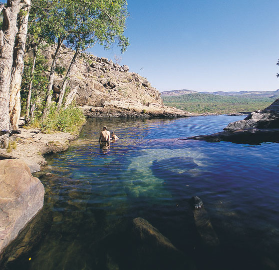
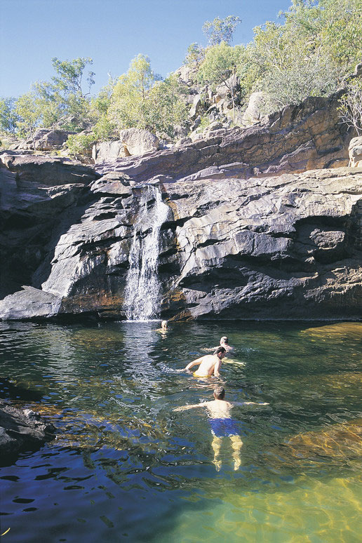
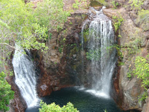
Visiting Gunlom Waterfall Creek in Kakadu Australia Gunlom, located on Waterfall Creek in World Heritage-listed Kakadu National Park, is the magical combination of waterfall and serene plunge pool, with shady gums cooling the picnic areas. A steep climb to the top of the waterfall provides sweeping views of the southern-most parts of Kakadu National Park while you enjoy a relaxing dip in the crystal clear pools. A steep lookout walk leads to rock pools and views of the southern hills and ridges. The flat, easy walk to Murrill Billabong is great for bird watching, as is the short walk to the main pool below the seasonal waterfall. There is a grassed, shady picnic area and camping facilities include solar-powered hot showers. Gunlom is part of Waterfall Creek, one of the major tributaries of the upper South Alligator River. This is the only large tropical river system in the world to be entirely protected within a national park and a World Heritage Area. The Jawoyn traditional land owners and Parks Australia hope you enjoy your stay at Gunlom.
Visiting Gunlom in Kakadu National Park Facilities:
• BBQ Facilities
• Car park
• Picnic Area
• Public Toilet
• Shaded Area Viewing Platform
Permits
See resource links
Walking:
Gunlom Lookout Walk
Features: Rock pools at the top of the falls and superb views
Distance: 1 km return
Grade: Difficult climb, marked track. Actually the repected book 'Take A Walk' grades this as 'Hard'. This short climb to the top of the escarpment is rather steep in my opinion. Though once there the views across the lands from the Gunlom lookout make it all worth the effort. A series of tranquil clear rock pools where you can relax away from the camping area at the bottom. Gunlom Gunlom Lookout Walk
Features: Rock pools at the top of the falls and superb views
Distance: 1 km return
Grade: Difficult climb, marked track.
Gunlom Plunge Pool
Features: Seasonal waterfall and a large plunge pool
Distance: 200 metres return
Grade: Disabled access
Murrill Billabong Walk
Features: A small seasonal billabong and the South Alligator River
Distance: Billabong 1 km return River 2.5 km return
Grade: Easy, marked track
Beyond Gunlom
Yurmikmik
Features: A network of walking tracks which take in the plunge pools and wet season waterfalls of the Marrawal Plateau.
Access: 2WD, camping permits required.
Carry a topographic map on longer walks.
Gimbat and Guratba (Coronation Hill)
Features: A scenic drive to a shady picnic area by the South Alligator River.
Access: 4WD only, day use only.
Gungurul
Features: A rest stop with picnic tables and toilets, lookout and short walk.
Access: 2WD, camping area.
Bukbukluk
Features: A lookout with superb escarpment views and a shady picnic area
Access: 2WD, day use only.
Maguk (Barramundi Gorge)
Features: A plunge pool and small waterfall
Access: 4WD recommended. Camping area.
Parks & Wildlife Commission of the Northern Territory
Head Office - Goyder Centre 25 Chung Wah Tce Palmerston, NT 0830
PO Box 496 Palmerston NT 0831
Ph: +61 (0) 8 8999 5511
-
Koolpin Gorge in Kakadu - National Park Australia - 4wd access track
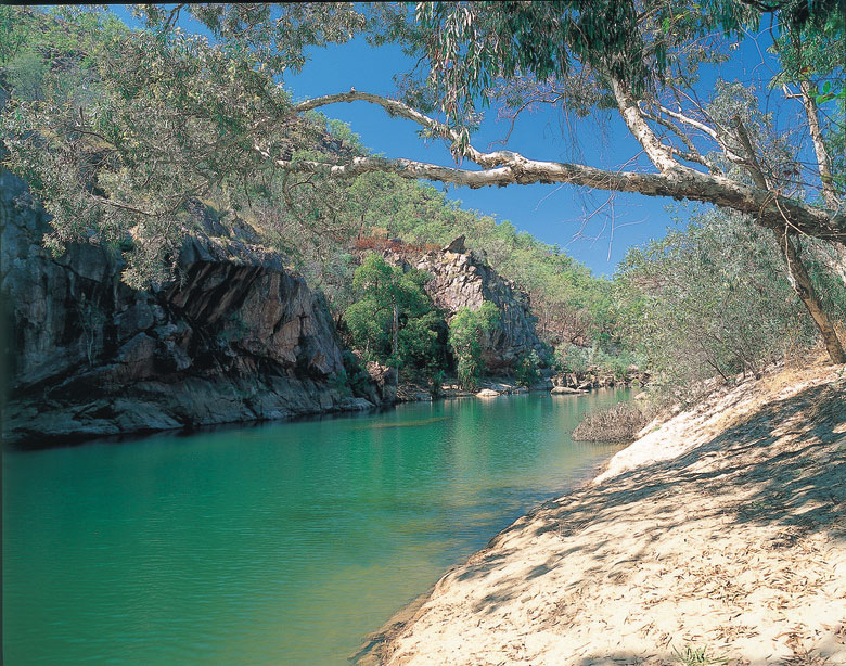
Jarrangbarnmi - Koolpin Gorge is located in World Heritage-listed Kakadu National Park. Jarrangbarnmi also known as Koolpin Gorge is in the south east corner of Kakadu National Park. You turn off the Kakadu Highway at the sign posted turn off to Gunlom Falls, up from the southern entry to Kakadu and 11km from the Wirnwirnmila (Mary River Roadhouse) not to be confused with the Mary River off the Arnhem Highway.(approx 89 km south-east from Cooinda Gagudju Resort and Yellow Water Cruise platform or app 149 km from the township of Jabiru. Approx 26.5 km down this 4WD track you get to an intersection Gunlom Falls (turn left) and Gimbat Picnic day use area (turn right). Here you turn left for Gunlom Falls approx 10klm on the left and right for Jarrangbarnmi - Koolpin Gorge Campground area. At app the 10 klm mark is the locked gate on the left which signposted turn off to Koolpin Gorge (see below for permits and access). further on you app 7klm come to Gimbat Picnic day use area. Jarrangbarnmi (Koolpin Gorge) is a restricted access area under the Environment, Protection and Biodiversity Conservations Regulations 2000 and a permit is required to enter this visitor site. Access is available only with a high clearance 4WD and only during the dry season.There is a limit of 40 people who are allowed to use the area at any one time and both independent travellers and tour operators have the opportunity to access the site. Permits are required for visitors wishing to enter the area for day use only and also for overnight camping.
Jarrangbarnmi (Koolpin Gorge) How to apply for this permit If you intend to apply for a permit to access Jarrangbarnmi (Koolpin Gorge), please download the application form, complete it, print it out, sign it, and post, fax or e-mail a scanned copy of the signed application and associated conditions with all required attachments to the address indicated on the form. Please allow a minimum of 7 days for processing. Applications can only be processed from Monday to Friday, between the hours of 9:00am until 4:00pm (CST). Permit applications will not be processed on weekends or public holidays. Note: All camp sites are subject to seasonal closure. Download the permit application form This permit application form is available as a Microsoft Word file click here for the Koolpin Gorge - Jarrangbarmiin permit application form. Access to Jarrangbarnmi (Koolpin Gorge) permit application form for Kakadu National Park (Word - 314 KB)
Self Drive Rentals and Hire to Jarrangbarnmi (Koolpin Gorge) in Kakadu Pational Park - permit required. Jarrangbarnmi - Koolpin Gorge in Kakadu National Park, Northern Territory Australia is most likely one of the least most travelled to destinations of our four wheel drive rental selfdrive clients. Though worth while if you take the time to obtain the correct information and permits. Choices for 4wd rental vehicles for this route are the Britz maverick, Britz Safari, Britz Warrior, especially the Britz Safari hire selfdrive vehicles. Also the Apollo Hilux Adventure camper 4WD vehicles for hire at Australia 4 Wheel Drive Rentals.
Access to Jarrangbarnmi (Koolpin Gorge) Application form Phone enquiries: +61 (0) 8 8938 1140 E-mail enquiries: kakadu.permits@environment.gov.au About this permit Jarrangbarnmi (Koolpin Gorge) is a restricted access area under the Environment, Protection and Biodiversity Conservations Regulations 2000 and a permit is required to enter this visitor site. Access is available only with a high clearance 4WD and only during the dry season. There is a limit of 40 people who are allowed to use the area at any one time and both independent travellers and tour operators have the opportunity to access the site. Permits are required for visitors wishing to enter the area for day use only and also for overnight camping. Applications for permits must be submitted seven days in advance of the time you wish to enter the area. These can only be processed from Monday to Friday, between the hours of 9:00am until 4:00pm. Permit applications will not be processed on weekends or public holidays.
Visiting Facilities at Koolpin Gorge Campground in Kakadu National Park • A car park/camping area adjacent to the downstream end of the gorge • A toilet adjacent to the car park • Fire rings/fire places - all fires must be contained within these areas • Generators are not permitted in the area.
Visitors Must Not Enter Sacred Site restricted Areas Visitors must not go ashore on the creek bank opposite the camping area. Refer to the signs on site. This is a sacred site and entry is prohibited under the Environment, Protection and Biodiversity Conservation Regulations 2000, specifically under Regulation 12.23. Entering a prohibited area under Regulation 12.23 carries a maximum penalty of $5,500. Visitors to the area must keep to the creek line. Some places away from the creek are important cultural sites and can only be visited by Jawoyn who have the authority to go there. Please show respect for the views of traditional owners in relation to these significant areas. Copyright and Courtesy of Parks NT.
Beyond Koolpin GorgeGunlom Lookout Walk
Features: Rock pools at the top of the falls and superb views Distance: 1 km return Grade: Difficult climb, marked track.
 Gunlom Plunge Pool
Features: Seasonal waterfall and a large plunge pool Distance: 200 metres return Grade: Disabled access
Murrill Billabong Walk
Features: A small seasonal billabong and the South Alligator River Distance: Billabong 1 km return River 2.5 km return Grade: Easy, marked trackYurmikmik
Features: A network of walking tracks which take in the plunge pools and wet season waterfalls of the Marrawal Plateau. Access: 2WD, camping permits required. Carry a topographic map on longer walks.
Gimbat and Guratba (Coronation Hill)
Features: A scenic drive to a shady picnic area by the South Alligator River. Access: 4WD only, day use only.Gungurul
Features: A rest stop with picnic tables and toilets, lookout and short walk. Access: 2WD, camping area.Bukbukluk
Features: A lookout with superb escarpment views and a shady picnic area Access: 2WD, day use only.Maguk (Barramundi Gorge)
Features: A plunge pool and small waterfall Access: 4WD recommended. Camping area.
Seasons
The dry season which is approximatley which is classed generally as May - October each year.Though in current year the wet has not set in till late December or January and then finishes mid April.Access To Koolpin Gorge
The dry season which is approximatley which is classed generally as May - October each year. Though in current year the wet has not set in till late December or January and then finishes mid April.
Are there certain times of the year that I can’t swim?
The seasonality of waterholes across the Northern Territory depend on the amount of rain throughout the year. NT Parks and Wildlife monitor water levels and erect signs advising visitors when it is safe to swim. Always obey sign posts. Check the latest access report on the web https://nt.gov.au/parksHow can you identify if a water-hole is safe to swim in?
Salt and freshwater crocodiles are found in most Top End billabongs and rivers, and are occasionally seen on remote beaches. The accessible rivers and billabongs are generally sign-posted if saltwater crocodiles are known to inhabit the area, but if you are not sure, don’t swim. Swim only where recommended and always observe and read the crocodile warning signs.Aren’t swimming spots hard to get to or only acesible as part of a tour?
All the swimming spots in Darwin, Litchfield National Park, Katherine, Mataranka and the MacDonnell Ranges are accessible by self-drive. A few locations are only accessible by four wheel-drive, such as Butterfly Gorge Nature Park and Tjaynera Falls in Litchfield National Park. Tour operators with swimming options include Adventure Tours Australia, Australian Pacific Touring, Connections Safaris, Odyssey Tours and Safaris and many more'.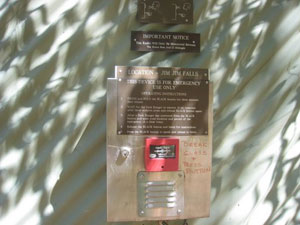
Emergency call devices: Emergency call devices are to be used in emergencies only. Follow the instructions located on the devices.Jarrangbarnmi is located in a remote area of Kakadu. Mobile phone reception is not available. An emergency radio is available at the carpark, which is monitored daily by Park staff from 0630 to 2230. It can be used in emergency situations to request medical help, or a search and rescue operation, or to notify park staff of any other incident where an urgent response is required.
Darwin RV camper rentals - 4wd hire
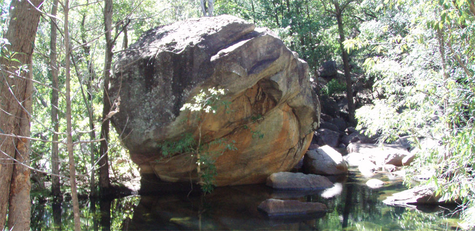
Motorcar Falls 4wd access track About Motorcar Falls (Motorcar Creek
Walk), Moline Rockhole, Kurundie
Falls and Boulder Creek in Kakadu National Park
Where Is Motorcar Creek Walk
Distance: 11 km return
Time: 7 hours, long day walk
Grade: difficult, unmarked track
Carry a topographic map and compass, or a GPS. Camping permit required. This walk follows the Motor Car Falls walk to Motor Car Falls. Then an unmarked section follows Motor Car Creek downstream to a series of lower falls. The adventurous may continue along the creek to the South Alligator River. Estuarine (saltwater) crocodiles live in the river so do not swim there. Return the way you came. This walk is most enjoyable in the wet season. Motorcar Falls can be reached via the Yirrmikmik Walk. The walk takes you through woodlands peppered with termite mounds and is approximately 7.5 km. Motor car falls was named in 1946 when the first vehicle to drive into the area, reached the creek and could not pass through. A bridge has since been built.
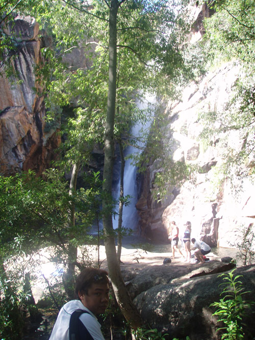
Where Is Moline Rockhole
Moline Rockhole is a little known, but beautiful, small waterfall and rockhole just several kilometres from Goymarr Tourist Park . Goymarr Tourist Park is in the process of developing a walking track between the Tourist Park and Moline. It is not signposted so you will need to ask directions at the Visitor Information Centre. Moline offers safe swimming for much of the year but you must first check Visitor Information Centre that's our advice.
Where Is Kurundie Falls
Motor Car and Kurrundie Creek Circuit
Walk Distance: 14 km return
Time: 10 hours, overnight walk
Grade: difficult, unmarked track
Kurundie Falls is located approximately 2km from Motor Car falls and is also accessable along the Yirrmikmik Walk. Kurundie often attracts less visitors as many people do not take the time to walk the extra distance. Carry a topographic map and compass, or a GPS. Camping permit required. Follow the old vehicle track past Yurmikmik Lookout to Kurrundie Creek, then follow the creek upstream to Kurrundie Falls. At this spectacular place you may see ngalmirla-mirla (peregrine falcon) flying from the cliffs. Also keep an eye out for barrk (black wallaroo) amongst the rocks. Follow the creek downstream through more falls to the South Alligator River. Estuarine (saltwater) crocodiles live in the river so do not swim there. Return to the carpark by following Motor Car Creek to the old bridge and vehicle track. Where Is Boulder Creek
Boulder Creek
Walk Distance: 2 km loop
Time: 45 minutes
Grade: moderate, marked track
Plum Tree Creek near the start of this walk is just a sandy creek bed during the dry season. It is named after mindu, the billygoat plum. Birn-birndok (striated pardalotes) and wirrirtwirrirt (rainbow bee-eaters) nest in the banks of this creek. After passing through open woodland the track leads to Boulder Creek, which is lined with a monsoon forest. Amongst the boulders are Garnbayn (fan palms). Listen and look for birds, like bukbuk (pheasant coucal). Feel the texture of the large sandstone and conglomerate boulders along the creek. Millions of years ago, the fine-grained sandstone was deposited as sand and silt under slow moving water. Pebbly conglomerates were laid down in fast flood waters. Follow the markers over the boulders across the creek and back to the carpark, or detour to the Yurmikmik Lookout. Where Is Yurmikmik Lookout
Yurm ikm ik Lookout
Walk Distance: 5 km return
Time: 1 1/2 to 2 hours
Grade: moderate, marked track
This walk goes through open woodland up a stony ridge to the lookout where you can enjoy views over Jawoyn country. To the north and west are the southern ridges of Kakadu. The large sandstone hill to the northwest is Bornluk. Look along the road for the lush ribbon of vegetation growing along the South Alligator River. To the south is the high flat country of the Marrawal Plateau. Marrawal refers to the seasonally swampy uplands between the South Alligator River and the Katherine River. The trees at the lookout with yellow-green bark are dirringgil (gardenia). Mungguy eat their fruits and use the resin as glue. Smell the fragrant flowers in the dry season. source | courtesy of environment.gov.au/ -
From Kakadu and around
Cutta Cutta Caves
Mataranka Springs
Mataranka Falls
Mataranka
Bitter Springs
Jatbula Trail
Edith Falls
Crystal Falls
Nitmiluk National Park Southern Rockhole
Areas near Jim Jim Falls Kakadu National Park Australia
Jim Jim unsealed track Kakadu
Garnamarr Campground Jim Jim Falls Region Kakadu National Park Australia
Hike bushwalk trek to Jim Jim Falls Gorge Kakadu National Park Guide
How to get to Maguk, Moline Rockhole, Gubara, Motorcar Falls, Gunlom falls, Koolpin Gorge
Twin Falls Kakadu National Park Australia
Jim Jim Falls Crocodile information
Maps of Kakadu National Park
Seasons in Kakadu
Douglas Hot Springs
Umbrawarra Gorge
Butterfly Gorge
-
 Katherine Gorge | Mataranka
Mataranka thermal Hot Springs, Edith Falls, Jatbula Trail, Southern Rockhole, Katherine Gorge, Butterfly Gorge, Umbrawarra Gorge, Douglas Hot Springs
-
 Kakadu National Park
Kakadu National Park - Koolpin Gorge, Maguk, Moline Rockhole, Gubara, Motorcar Falls, Gunlom Falls. We can assist you book a 4wd Darwin rentals.
-
 Litchfield National Park
Litchfield National Park Together with stunning tropical waterfalls and swimming holes, this is a truly beautiful destination found just one hour south of Darwin.